
Metro's First Offering Isn't Great, but There are Transit Apps for L.A.
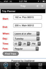 Screenshot
Metro's new LAMetro app
DOWNTOWN LOS ANGELES — Metro last week released a free application designed to guide iPhone users toward easier transit use, offering access to nearby bus and rail stops, trip planning and basic rider information.
The program, freely available , channels functionality available on Metro's website into a more mobile package.
That's both a blessing and a curse.
The LAMetro app, programmed for Metro by developer Usablenet, suffers under the general lack of smarts shown by the transit agency's Trip Planner functionality, which hasn't seen any significant updates since its unveiling in early 2005.
At the time, the agency touted the new system as a step forward from the third-party software that it had previously licensed. Fast forward to 2010, though, and its interface and functionality feels positively archaic.
Try to use the planner to get around Downtown, and you're likely to get buried in a sea of similar options that lack sorting or differentiation. A search for directions to City Hall from blogdowntown's current quarters at Pico and Hill produces 31 options, all shown quite optimistically as taking less than 15 minutes.
The iPhone version doesn't do much to improve matters. It selects one trip instead of presenting a list of options, but does so in a manner that is unlikely to make sense for Downtowners. For that trip from Pico and Hill to City Hall, the LAMetro app would have us walk a half mile to Olive and Olympic to catch Foothill Transit's Silver Streak, paying $2.75 for the seven minute bus ride. A smarter rider would walk just a block to 12th and Hill, catching the DASH D for only $0.35.
The app also misses the chance to allow the user to use his or her current location for the trip's starting point, and doesn't offer any saved state information if the rider happens to exit the trip midway. The extensive use of Metro's website for data also means that a constant Internet connection is required, a downer for those who would wish to use the app in subway tunnels or on an iPod touch.
Metro and Usablenet tout the app as "Build 1.0," which does leave the door open for improvements, but Downtown transit riders might want to load up a few handy tools in the interim.
, by Patrice Bernard & Frank Van Caenegem, is also available . The application can be loaded up with data for hundreds of cities worldwide and offers locally-computed routing information that doesn't require the use of a network connection. The iPhone's GPS can be used to compute a starting or ending point and the Los Angeles data offers a useful database of points of interest and nearby transit stops.
While it isn't an app, the mobile version of offers realtime information for DASH riders on the go. The site requires a general understanding of which of the system's five Downtown lines go where, but then offers live arrival time information for each stop. Developed by Syncromatics, the company contracted to provide the GPS systems in DASH buses, the system also offers the ability to get arrival information by telephone (call ) or text message.


Walmart drew Downtown protests, but why...
Construction begins on $72 million bus...
Construction begins on $72 million bus...
Construction begins on $72 million bus...
Donated collection of maps is like 'Christmas...