
Metro Says Welcome to the New Second Street
 Metro
Metro
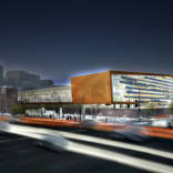
DOWNTOWN LOS ANGELES — This image from Metro's Tuesday night presentation shows the transit agency's rendering of what 2nd street would look like with at-grade rail operation. Pictured is 2nd approaching Main street. The new LAPD headquarters is at left, with the Higgins building on the right.
Auto traffic would be reduced to one 11-foot lane for local access. At the meeting, one commenter questioned whether the fire department would even sign off on that, given that it typically requires closer to twenty.
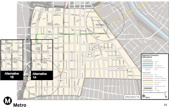
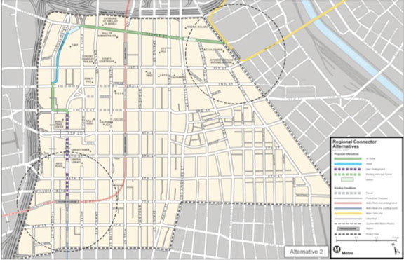
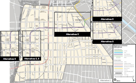
As reported last night, four of the eight alternatives would run at-grade on 2nd street. After the jump, images of all eight alternatives presented last night. Metro emphasized that it is still early in the process, but the chosen study options represent their current thinking.
Alternative 1: Comes above ground on Flower before 3rd. At grade onto 3rd, Figueroa, into the 2nd street tunnel, and then 2nd through Little Tokyo.
Alternative 2: Comes above-ground on Flower, turns onto 3rd, onto Figueroa, then wraps around DWP to Temple street and takes that until the Gold Line.
Alernative 3: Subway into the 2nd street tunnel, pops up in the tunnel, then at-grade on 2nd to Main and Los Angeles, using the two to connect to Temple street and take that to the Gold Line. Alternative 7 is the same, except using only Los Angeles.
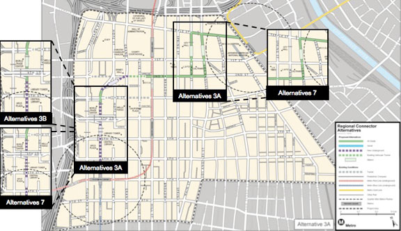
Alternative 4: Subway into the 2nd street tunnel, at-grade in the tunnel, then surface operation down 2nd through Little Tokyo.

Alernative 5: Subway operation all the way through Little Tokyo, then surfacing to run across Alameda and 1st to connect to the Gold Line.
Alternatives 6 & 8: 100% subway operation, including reconstruction of the connection to the Gold Line. Differ in whether they tunnel under right of way or under Little Tokyo Plaza. Metro currently says that either of these options would require losing the Arts District / Little Tokyo station.

Walmart drew Downtown protests, but why...
Construction begins on $72 million bus...
Construction begins on $72 million bus...
Construction begins on $72 million bus...
Donated collection of maps is like 'Christmas...